
07/04/17
I had the day off of work, and decided that the day couldn’t be better spent than by climbing the two peaks that I left out when climbing Colvin and Blake. I left the house at 4am, thinking that the trails might be crowded despite being a Tuesday since it was Independence Day. I enjoyed the sights of dense fog lifting with the sunrise on the drive down.

I arrived at the trailhead at St. Huberts just before 6am, put my boots on, and set off toward lake road.


15 minutes later I arrived at the register, signed in, and started my long trek down Lake Rd. I had read mixed reports about whether to climb these mountains clockwise or counterclockwise; many people suggested climbing clockwise, going up Leach trail and coming down Elk Pass because Elk Pass is very steep despite being only 1.5 miles long. However, I would much rather climb up a steep path than down it, and I wanted to do the long lake rd walk early in the hike as a warm up, so I chose to go counterclockwise, anticipating a miserable climb up Elk.


I noticed two signs for “Flume” while I was walking, and decided to check out the latter. Without backtracking all the way, I walked just a few feet along the little spur trail to see some awesome waterfalls.


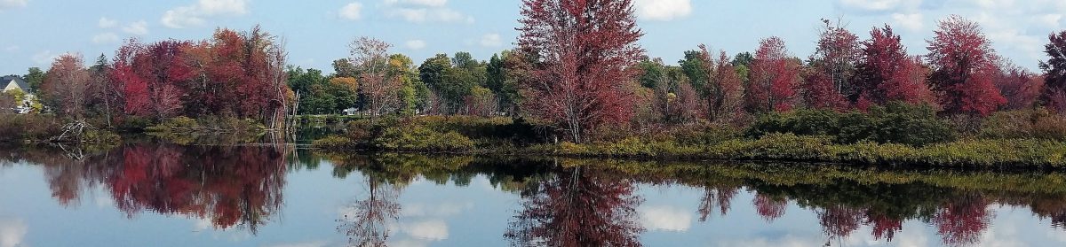
Usually the walk along lake is boooring, however this time, just as I was cresting a hill, a sweet little spotted fawn came galloping toward me from the other side! She skidded to a stop, as did I, and we stared at each other in shock for a few moments before she bolted into the brook alongside the road, and watched me while floating in a little pool. Hopefully that baby’s momma was close by!

I passed the first sign for Gill Brook, and continued until I saw the second sign for Gill Brook cutoff, while I reached at about 7am, an hour after leaving from the parking lot.

The trail climbed slowly but steadily from this point until reaching the junction with the Gill Brook Trail 20 minutes later.


I went right, up towards Colvin, and ruefully continued straight past the junction for Indian Head a few minutes later. Indian head is amazing, but I’d already been there a month before and wanted to see new things.

The trail climbed pretty steadily on the way up towards Colvin. I hadn’t been bothered by bugs yet, but it was still quite early. I had also expected a ton of mud due to the recent deluge, and though there were muddy areas, none of them were sloppy, boot-slurping mud. After climbing up some rock slabs and stone steps, my stomach started complaining loudly, so I decided to take a short break just before 8am and have a snack.


After a little over a mile of climbing, I reached a decrepit sign at the junction for Elk Pass, Colvin, and Lake Rd at 8:30am. Two of the signs had fallen (presumably recently, because I think they were intact when I was there before), and I spent a moment with a couple of other hikers to ensure we were all going the right way. I headed left from the direction I came to go towards Nippletop.


The trail picked up again, climbing steadily, and I started hearing sounds that seemed out of place for a mountain trail….Frogs. It didn’t make any sense to me, and definitely made me pause for a moment or two in confusion, until the trail took a downward turn and I found myself on a muddy, overgrown little path through a bog. I excitedly took a little spur in the trail to view the bog, and the lumber supplies that hopefully mean a bridge will be built in the future.

It was so beautiful here. After a very quiet morning, the birds were waking up and the frogs were certainly lively. More than once while walking I stepped in what I thought was shallow mud and nearly left my boot behind in foot-deep muck. I’d laugh to myself, remove my foot, and immediately do it again. I was pleasantly surprised moments later to see another small pond, on the right this time, and took the opportunity for a short break.


At this point, the trail was almost lower than the level of the ponds, and boy did it show. The mud was ridiculous, and much more along the lines of what I had expected. I passed through the absolutely worst of it by balancing precariously on a sodden, broken log, and made it to dry land. THEN I took out my pole to help with any future mud. Better late than never!


I had reached a nice dry clearing with views of another small pond, which I later saw was a campsite, and then headed up the trail again.

This is when the real ascent up Elk Pass starts. Honestly, I wasn’t even really convinced I was on Elk Pass until I was almost to the summit of Nippletop because it was so much easier than everyone made it seem. I was expecting some beast with giant rock slabs and slick slides all the way up. While it was indeed steep and constant, it wasn’t at all technically difficult. For reference, I always carry my camera around my neck while hiking and put it away during difficult sections; I never even had to put it away during this entire hike.

The grade was certainly tiring, and I made myself stop for 5 minute breaks every hour (which really helped with muscle fatigue), but it was made so much better by the views I had almost every time I turned around.


While it wasn’t technically difficult, this trail seemed to go on FOREVER. Finally, at about 10:15am, I reached the crest in the ridge and the junction for Nippletop and Dial, and headed right.


20 minutes later and I was standing next to a big rock, asking a man standing nearby “Is this it?” It was indeed! Climbing out onto the rocks, I was blown away by the views of the Dix range.


I hung out at the top for about an hour, chatting with a few different people (shoutout to Doug from Delaware, the surgeon!–I’m trying really, really hard lately to remember things about people…like their names.) and enjoying my lunch and victory chocolate.


I took a photo for a pair of ladies, they returned the favor, and I convinced them to do the loop down elk pass to visit Indian Head. Seriously, the views from Indian Head are some of the best around.


Finally, at around 11:30, I decided I had to make the move to head towards Dial. Bugs had started to show their ugly stupid faces with the warming sun and mud, flies and sandflies and mosquitos and all, but they weren’t really a nuisance while I was moving, so off I went. I passed the junction with Elk Pass and marveled at the view of Giant Mtn to the NE.

Everyone I had previously spoken to had said that the trail was all downhill after leaving Nippletop heading toward Dial, Bear Den, and back to Lake Rd. This was totally not true, and I had gotten pretty frustrated at having expected it to be so much easier. It was more like, down then up, then down then up to Dial, then down then up to Bear Den, then down then up to Noonmark Shoulder, then down….Anyway, I passed several people travelling the other way while heading to Dial, and asked every one of them if I had accidentally passed over Dial without realizing it…I just kept going downhill, I thought for sure I had missed it!


Along the way, I spied a little spur trail off to the right just before noon, so of course I took it and found some beautiful views from a large boulder!


Finally, 2.1 miles and about an hour after leaving the summit of Nippletop, I reached the summit of Dial Mountain. For some reason, I was expecting the summit to have no views, however I was thrilled to see a huge boulder outcropping.


I hopped right up, and eagerly sat down to enjoy an apple, and snapped a few photos.


Unfortunately, within 5 minutes of being up there, I was SWARMED by sandflies! These things are awful! Despite having a cap coated in permethrin and being covered head to toe in deet, these things just did not care. One after another I was swatting them off of my hands, my neck, my face, and even from up under my cap. At one point, I took the deet out of my pack and literally sprayed it into the swarm, and they gave me one of these:

So I packed my stuff up and courageously ran like hell off of the summit, without even having my apple snack. After a hundred feet or so I slowed back down and lamented my short stay on the summit. The trail immediately went downhill for about a mile before climbing again up to the summit of Bear Den (1:30pm). There weren’t any views from Bear Den that I could see, and I didn’t even realize I had reached the summit until I saw the sign at Noonmark saying I had already passed Bear Den.

After a half mile descent from Bear Den, The trail again began climbing. While somewhat demoralizing to be climbing again (my knees were hurting from all of the ‘down’, and going up only means climbing right back down, and then some), the trail up to the W shoulder of Noonmark Mtn was stunning. A fire had ravaged the area in 1999, creating now-beautiful views from the summit of the shoulder and a unique young forest full of birch and aspen trees, with white bark and bright green leaves.

I climbed the slab up to the shoulder and plopped my butt down. The views were AMAAAAAZING. I wanted to sit there for so much longer than I did, but alas, bugs. Writing this the day after the hike, I have a number of itchy bites, where mosquitos had bitten THROUGH MY DEET-SOAKED PANTS. What even are these things?! How do I prevent this?! Grenades?! Ugh.


After only a few minutes respite, I continued on up and over the shoulder and again headed downhill through the beautiful forest and some mud.


From here on out the trail was much easier. There was less mud and the decline was less rocky. At some point I passed this beautiful little mushroom, still somehow intact despite residing in the middle of the trail.

A mile and a half later I was back on Lake Rd, and at the parking lot at about 3:45pm, about 9hrs and 45 minutes after leaving.


I learned some valuable information on this trip:
1. Adirondack bugs don’t give a hoot whether you’re wearing deet or permethrin. If they’re hungry, you’re lunch.
2. Elk Pass wasn’t bad at all, and I would recommend any and everyone go up Elk and down Leach, for several reasons. First, you get the long walk down lake road out of the way early on, and it serves as a nice warm-up before any climbing. Second, you reach Nippletop for some awesome views faster than you would if coming from the Leach Trail. Third, it’s easier to climb up steep, slippery rocks than to climb down them.
3. The Fourth of July isn’t a crazy busy hiking day when it’s during the week (except maybe on a Monday or Friday). I only saw a handful of people all day. Good to know!
13 down, 33 to go! Happy Trails!
Nippletop Mountain: 4620′
Dial Mountain: 4020′
Bear Den: 3399′
Total Duration: 8.5 hours of hiking + 1.25 hours at summits
Round Trip Distance: ~14 miles
All images are property of adktrailtalesandtails and may only be used with express permission.

Great trip report! I just did this yesterday and felt the same way about the up and downs after Nippletop top. I started mumbling to myself, what goes down must come up! Also, the bugs on Dial are relentless!! I agree, Elk pass is not very technically, just long and steep. I had to take many breaks! Beautiful pictures, thank you for sharing!
LikeLike
Thanks for reading! Seems like we had a very similar experience 😂 congrats for getting these two done!
LikeLike